
Welcome to Waccamaw River Source-to-Sea!
This website is an attempt to keep record of data in various categories for future kayakers as the
sport continues to grow. Our hope moving forward is to allow people an opportunity to share
experiences with one another. The collective information on water levels, objective hazards,
viable campsites, and other empirical data can only serve to inspire and promote future
exploration and the undertaking of personal challenges.
The Waccamaw is unique in the fact that it is easy to pinpoint the exact start and completion of
the river’s course. Furthermore, the Waccamaw has not been dammed, thus providing
a clearcut path along its route.
For kayakers who aspire to paddle the river in its entirety, the proximity to the coast is especially
beneficial, as it makes it easy for others to join the paddler along the way, transforming the
adventure into a celebration of the river itself.
We realize there are other people who have paddled the Waccamaw either sectionally or straight
through that we are unaware of. We want to invite people who have experienced this adventure to
share their accomplishments through our submission form. We look forward to hearing more stories!
About the Waccamaw...
Approximately 15 miles inland from the Atlantic seaboard, the Waccamaw River flows south-
southwest from its headwaters at Lake Waccamaw, North Carolina before emptying into the
Winyah Bay in Georgetown, South Carolina—140 miles downstream. Historically, culturally
and economically, the Waccamaw has played a significant role in the region, and continues to do
so.
Although the exact origin of the term “Waccamaw” remains unclear, the native Waccamaw
(Siouan) tribe refer to themselves as the “people of the falling star” in reference to the geological
formation of Lake Waccamaw specifically. The largest of all naturally-formed Carolina Bays,
Lake Waccamaw was presumably created around 12,900 years ago during the violent conclusion
to the Pleistocene Epoch.
It is only during recent times that the importance of the Waccamaw has been revisited, and more
interest taken into its nearly-forgotten past. England issued many land grants to would-be settlers
along its shores in the 18th century. During this same time period, logging in the region took hold,
and the river proved instrumental in the ability to transport downed trees to the hub city of
Conwayborough and the port city of Georgetown. One byproduct of logging was the production
of turpentine, which eventually fizzled out by the late 19th century. Additionally, the lower sections of
the Waccamaw once boasted some of the most productive rice plantations in South Carolina.
Residents near the coast of South Carolina increasingly looked upon the Waccamaw for
recreational opportunities. What began as fishing, swimming, and canoeing gave way to a new
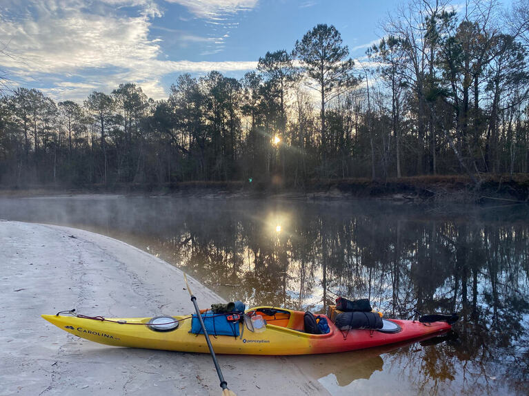
sport that began to take hold—kayaking! From the vantage point of a kayaker, the Waccamaw
River is extremely inviting for numerous reasons, not the least of which is it's natural beauty.
Beginning as not much more than a trickle in the vastness of Green Swamp, the river maintains
it's blackwater complexion throughout the bottomland hardwood regions before gaining a vast and
new identity near the Waccamaw Neck. The lower portion of the river transforms into a
considerably large saltwater estuary at its mouth in the Winyah Bay.
Conveniently, there are many public access points along its course, but most of the river is wild
and it's surrounding lands are true wilderness. Conservation efforts provided by the Waccamaw
National Wildlife Refuge, the Winyah Rivers Alliance, and the Waccamaw Riverkeepers—in
addition to the many volunteer programs and events—have provided lasting hope for future
generations. Unfortunately, there have been many poorly-planned developmental practices that
have threatened the river’s beauty and clarity. These issues need to be further addressed.
The Waccamaw river is a priceless attribute to our community and region. We hope to
encourage others to embrace and protect our Lady Waccamaw for future generations to enjoy as
we have.
~
In the year of 1875, Nathaniel Holmes Bishop descended the Waccamaw alone in a paper
mache canoe. This famous expedition was chronicled in his publication, Voyage of the Paper
Canoe, and is significant in tracing our earliest known trip down the river. The Waccamaw River
section was only a portion of Bishop's 2500-mile journey from Quebec to the Gulf of Mexico.
In 1985, Conway native Franklin Burroughs set out to repeat Bishop's voyage, also alone in an open-
deck canoe, as recounted in his fantastic book, Horry and the Waccamaw. This book was later re-
released under the title The River Home: A Return to the Carolina Lowcountry. Burroughs
describes his own personal journey, piecing together the human and natural histories of the
region, and arriving at an understanding of the river’s true essence.
Both Bishop and Burroughs, in their beautiful watercraft and symbolic journeys, diverted from
the river some 25 miles from its mouth, taking Bull Creek so as to finish on the Pee Dee river.
Consequently, neither paddled the entire Waccamaw.
The navigable portion of the Waccamaw River is commonly referred to as the Waccamaw River Blue Trail and was recognized as a keystone project in 2012 as part of America’s Great Outdoors Program. In 2013 the 100 mile stretch of the river that lies with the state of South Carolina was officially designated as a National Water Trail by the National Park Service of the United States Department of the Interior.
southwest from its headwaters at Lake Waccamaw, North Carolina before emptying into the
Winyah Bay in Georgetown, South Carolina—140 miles downstream. Historically, culturally
and economically, the Waccamaw has played a significant role in the region, and continues to do
so.
Although the exact origin of the term “Waccamaw” remains unclear, the native Waccamaw
(Siouan) tribe refer to themselves as the “people of the falling star” in reference to the geological
formation of Lake Waccamaw specifically. The largest of all naturally-formed Carolina Bays,
Lake Waccamaw was presumably created around 12,900 years ago during the violent conclusion
to the Pleistocene Epoch.
It is only during recent times that the importance of the Waccamaw has been revisited, and more
interest taken into its nearly-forgotten past. England issued many land grants to would-be settlers
along its shores in the 18th century. During this same time period, logging in the region took hold,
and the river proved instrumental in the ability to transport downed trees to the hub city of
Conwayborough and the port city of Georgetown. One byproduct of logging was the production
of turpentine, which eventually fizzled out by the late 19th century. Additionally, the lower sections of
the Waccamaw once boasted some of the most productive rice plantations in South Carolina.
Residents near the coast of South Carolina increasingly looked upon the Waccamaw for
recreational opportunities. What began as fishing, swimming, and canoeing gave way to a new
sport that began to take hold—kayaking! From the vantage point of a kayaker, the Waccamaw
River is extremely inviting for numerous reasons, not the least of which is it's natural beauty.
Beginning as not much more than a trickle in the vastness of Green Swamp, the river maintains
it's blackwater complexion throughout the bottomland hardwood regions before gaining a vast and
new identity near the Waccamaw Neck. The lower portion of the river transforms into a
considerably large saltwater estuary at its mouth in the Winyah Bay.
Conveniently, there are many public access points along its course, but most of the river is wild
and it's surrounding lands are true wilderness. Conservation efforts provided by the Waccamaw
National Wildlife Refuge, the Winyah Rivers Alliance, and the Waccamaw Riverkeepers—in
addition to the many volunteer programs and events—have provided lasting hope for future
generations. Unfortunately, there have been many poorly-planned developmental practices that
have threatened the river’s beauty and clarity. These issues need to be further addressed.
The Waccamaw river is a priceless attribute to our community and region. We hope to
encourage others to embrace and protect our Lady Waccamaw for future generations to enjoy as
we have.
~
In the year of 1875, Nathaniel Holmes Bishop descended the Waccamaw alone in a paper
mache canoe. This famous expedition was chronicled in his publication, Voyage of the Paper
Canoe, and is significant in tracing our earliest known trip down the river. The Waccamaw River
section was only a portion of Bishop's 2500-mile journey from Quebec to the Gulf of Mexico.
In 1985, Conway native Franklin Burroughs set out to repeat Bishop's voyage, also alone in an open-
deck canoe, as recounted in his fantastic book, Horry and the Waccamaw. This book was later re-
released under the title The River Home: A Return to the Carolina Lowcountry. Burroughs
describes his own personal journey, piecing together the human and natural histories of the
region, and arriving at an understanding of the river’s true essence.
Both Bishop and Burroughs, in their beautiful watercraft and symbolic journeys, diverted from
the river some 25 miles from its mouth, taking Bull Creek so as to finish on the Pee Dee river.
Consequently, neither paddled the entire Waccamaw.
The navigable portion of the Waccamaw River is commonly referred to as the Waccamaw River Blue Trail and was recognized as a keystone project in 2012 as part of America’s Great Outdoors Program. In 2013 the 100 mile stretch of the river that lies with the state of South Carolina was officially designated as a National Water Trail by the National Park Service of the United States Department of the Interior.
|
|

|

|